

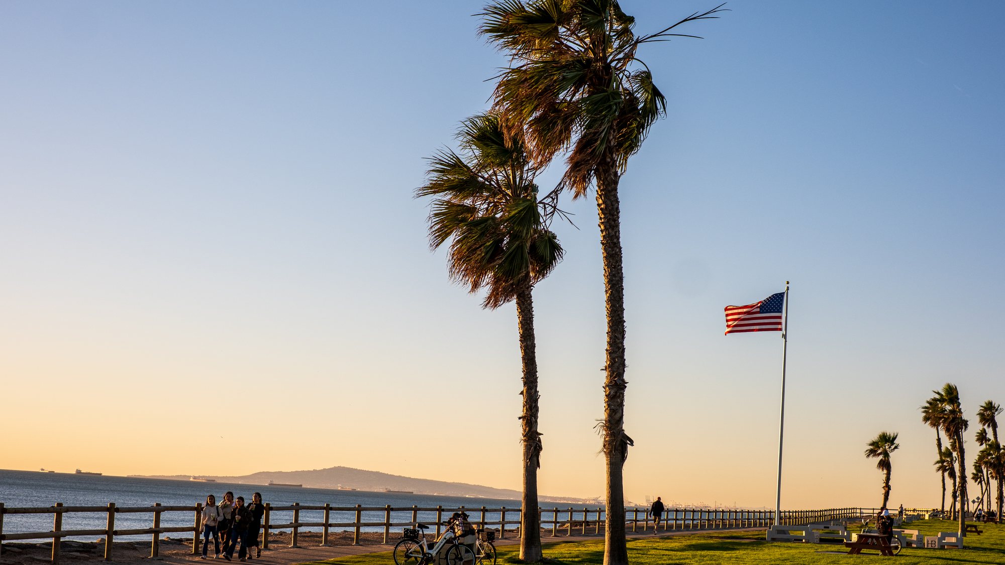
Living in Huntington Beach
Huntington Beach is in Orange County, not Los Angeles County. It sits on the coast with Seal Beach to the northwest, Westminster and Fountain Valley inland, Costa Mesa to the east and Newport Beach to the southeast. The town was called Pacific City until 1903, when it was renamed for Henry E. Huntington of the Pacific Electric Railway. The first pier was built in 1904 and the city incorporated on February 17, 1909.
Two things shaped what you see today. The first Huntington Beach oil well came in on May 24, 1920, and the field under the city still produces. Then came the tract builders: the city's housing element says most owner-occupied homes here were built before 1980, the bulk of them in the 1960s and 1970s. Huntington Harbour was started in 1963, Huntington Central Park was dedicated in 1974, and Sunset Beach was annexed on August 22, 2011.
For a newcomer the layout is simple. Pacific Coast Highway follows the shore. Beach Boulevard, State Route 39, runs from the 405 in the northeast corner down to the sand. Main Street meets the pier Downtown, with the Civic Center farther up Main at Yorktown Avenue and Central Park in the middle of the city. The Bolsa Chica wetlands separate Huntington Harbour and Sunset Beach from the rest of the coast.
Homes and property types in Huntington Beach
Most of inland and southeast Huntington Beach is single-family tract housing from the 1960s and 1970s. A house of that age may still have its original drain lines, electrical panel and windows, and many have been added onto. Ask the inspector for a sewer camera inspection and ask Tony to pull the permit history for any addition, garage conversion or second story.
Near the water the stock changes. The city's historic resources element says much of Downtown's one-story beach cottage character has given way to three-story beach houses, so old and new sit side by side on narrow lots. Sunset Beach has about 652 homes on lots that are typically 2,700 square feet, by the city's specific plan. Huntington Harbour is waterfront houses and condominiums on boating channels, most built from the 1960s through the late 1970s.
The newer single-family neighborhoods are on former oil land around Seacliff. The Holly-Seacliff Specific Plan covers 565 acres of detached homes, townhomes and condominiums. The Palm/Goldenwest plan area is a former Chevron oilfield. Brightwater, on the Bolsa Chica Mesa, was permitted in 2005 for 349 single-family homes. Recent building has mostly been apartments and mixed use along Beach Boulevard and Edinger Avenue.
Attached and lower-cost options are spread across the city: condominiums, townhomes and 18 mobile home parks, by the count in the city's housing element. In a park you buy the home and pay space rent for the land, and some attached communities also sit on leased land. Huntington Landmark is an age-restricted 55+ community of 1,238 homes on 160 acres, according to its association.
Huntington Beach neighborhoods and tracts
Huntington Beach is large enough that the neighborhood matters more than the city name. The city's own ZIP code shorthand is a fair start: 92647 is the northeast, 92646 the southeast toward the Santa Ana River, 92649 the west side including Huntington Harbour, 92648 the coast and Downtown, and 90742 is Sunset Beach. Several areas below are governed by a city specific plan, which is the document to read before planning a remodel. Confirm any homeowners association from the title report.
- Huntington Harbour
- Northwest corner, between Naval Weapons Station Seal Beach and the Bolsa Chica reserve. Begun in 1963 on channels around five man-made islands: Admiralty, Davenport, Gilbert, Humboldt and Trinidad. Waterfront houses with docks, plus condominiums.
- Sunset Beach
- The beach strip along Pacific Coast Highway from Warner Avenue north to Anderson Street. Annexed in 2011, ZIP 90742, with its own specific plan and a 13-acre greenbelt park down the middle.
- Downtown
- Main Street and the blocks around the pier, under the Downtown Specific Plan. Narrow lots, older cottages beside newer three-story homes, condominiums and shops within walking distance of the sand.
- Seacliff
- The Seacliff Specific Plan area runs from Garfield Avenue south to Pacific Coast Highway, west of Goldenwest Street, around the Seacliff golf course. Planned community of single-family homes and townhomes.
- Holly-Seacliff
- 565 acres in the center of the city between Central Park and the Civic Center. Planned for small-lot detached homes, townhomes and condominiums on land that was part of the oil field.
- Ellis-Goldenwest (Edwards Hill)
- 160 acres bounded by Ellis Avenue, Edwards Street, Garfield Avenue and Goldenwest Street, just south of Central Park. Estate-size lots, with public equestrian trails required by the specific plan.
- Palm/Goldenwest
- 150 acres between Palm Avenue and Pacific Coast Highway, from Goldenwest Street to Seapoint Street. A former oilfield; the plan allows up to 315 homes on the 54-acre residential part.
- Brightwater
- On the northeast corner of the Bolsa Chica Mesa above the wetlands. Approved in 2005 for 349 single-family homes and annexed to the city in phases as it was built.
- Huntington Landmark
- Age-restricted 55+ community in the southeast part of the city, ZIP 92646. The association counts 1,238 homes on 160 acres. Attached homes with an HOA and shared amenities.
Schools and district boundaries
One district runs the public high schools: Huntington Beach Union High School District, grades 9 to 12. Huntington Beach, Edison, Marina and Ocean View high schools are inside the city, and the district also runs Fountain Valley and Westminster high schools next door, plus Valley Vista and Coast for continuation and independent study.
Below ninth grade the city is split among four separate K-8 districts, and the lines do not follow neighborhood names. Huntington Beach City School District has six elementary schools and two middle schools. Ocean View School District has ten elementary schools and three middle schools. Westminster School District has three schools inside north Huntington Beach, and Fountain Valley School District also takes part of the city.
The high school district says plainly that it does not keep boundary detail for the four elementary districts, so do not rely on a listing. Each district has an address lookup: My School Locator for Huntington Beach City, Locate My School for Ocean View, and the School Locator on the high school district site. Confirm the assigned schools for the exact address with the district before you write an offer. Golden West College, a community college, is also in the city.
- Huntington Beach Union High School District
- Grades 9-12. Six comprehensive high schools across Huntington Beach, Fountain Valley and Westminster, fed by four K-8 districts. District office is on Bolsa Avenue in Huntington Beach.
- Huntington Beach High School
- Grades 9-12, at 1905 Main Street, founded in 1906. Home of the Huntington Beach Academy for the Performing Arts.
- Ocean View High School
- Grades 9-12, at 17071 Gothard Street, opened in 1976. Listed as the only school in the district offering the International Baccalaureate program; confirm current offerings with the school.
- Huntington Beach City School District
- Elementary schools (TK-5): Eader, Hawes, Moffett, Peterson, Seacliff and Smith. Middle schools (6-8): Dwyer and Sowers. District office is on Dorsett Drive in 92646.
- Ocean View School District
- Transitional kindergarten to grade 8. Ten elementary schools and three middle schools: Marine View, Mesa View and Vista View. The district also has campuses in Fountain Valley, Westminster and Midway City.
- Westminster School District
- Runs Clegg Elementary (K-5), Schroeder Elementary (K-6) and Stacey Middle School (6-8) inside Huntington Beach, serving part of the north end of the city.
What it costs to own here beyond the price
Under Proposition 13 a home is reassessed to its purchase price when it sells, so your property tax starts from what you pay, not from the seller's bill. On Mello-Roos, the city's budget lists three community facilities districts, and each is tied to a commercial site: the Grand Coast Resort on the waterfront, the McDonnell Centre Business Park and the Huntington Center, now Bella Terra. Most houses in the older tracts carry no city Mello-Roos. Read the tax bill for the address anyway.
Homeowner association dues come with the condominium and townhome communities, the planned areas around Seacliff and Huntington Landmark. Water and sewer come from the City of Huntington Beach, which pumps about three-fourths of its water from local wells. Electricity is Southern California Edison, gas is SoCalGas and trash is Republic Services. In Sunset Beach, sewer and trash go through the Sunset Beach Sanitary District and are billed on the property tax bill.
Flooding is checked address by address. The city names the Santa Ana River, three flood channels and the ocean as sources, and says FEMA's maps put parts of Huntington Harbour and Sunset Beach in coastal high-hazard zones. A home in a Special Flood Hazard Area needs flood insurance if the loan is federally regulated or insured, and a remodel there worth half the building's value must meet the city's floodplain rules. Much of the coast is also in the Coastal Zone, which can add a permit step. Get insurance quotes early.
The ground matters too. The city's general plan says the Newport-Inglewood Fault Zone runs through town, that liquefaction risk is higher near the coast and in Huntington Harbour, and that it has mapped methane overlay districts on former oil land. CAL FIRE's 2025 map shows fire hazard zones on open land at Bolsa Chica; the built city is mapped non-wildland. Short-term rentals need a city permit and must be hosted, except for Sunset Beach rentals permitted by March 1, 2022. Have Tony check each of these for the address.
Parks, shopping and things to do
The city counts 79 parks and public facilities covering 767 acres, plus its public beach. The pier at the foot of Main Street is 1,850 feet long; the present concrete pier was dedicated in 1992. Huntington Central Park is the big inland park, with the Central Library, which opened in 1975, a nature center, an equestrian center with public trails, a disc golf course set up in 1977 and a dog park off Edwards Street.
For shopping, Bella Terra sits by the 405 at Edinger Avenue on the site of the old Huntington Center mall, Pacific City faces the ocean on Pacific Coast Highway, and Main Street is the Downtown strip. The yearly calendar includes the Fourth of July parade, first held in 1904, the U.S. Open of Surfing beside the pier each summer, the Pacific Airshow over the beach, first held in 2016, and the Surf City USA Marathon.
- Huntington Beach Pier
- At Main Street and Pacific Coast Highway. 1,850 feet long, rebuilt in concrete and dedicated in July 1992, and listed on the National Register of Historic Places.
- Huntington Central Park
- 343.24 acres, dedicated June 15, 1974. Four playgrounds, lakes, the Shipley Nature Center, an equestrian center, a disc golf course, a dog park and the Central Library on Talbert Avenue.
- Bolsa Chica Ecological Reserve
- State wetland reserve between Warner Avenue and Seapoint Street along Pacific Coast Highway. More than 1,300 acres, a four-mile trail network and an interpretive center on Warner.
- Edison Park
- 39.69-acre community park in the southeast with a community center, lighted softball, soccer, tennis, pickleball and a skate spot. Dedicated in 1974.
- Bartlett Park and the Newland House
- 27.73 acres of natural open space off Beach Boulevard, behind the Newland House Museum. The Newland House dates from 1898.
- Bella Terra
- Open-air center at 7777 Edinger Avenue by the 405. The enclosed Huntington Center opened here in 1966; it reopened as Bella Terra in 2006.
Getting around and commuting
The 405 crosses only the northeast part of the city, so the beach neighborhoods are several miles of surface streets from a freeway. By road the pier is about 7 miles from Bella Terra and the 405. Beach Boulevard, State Route 39, is the main way down, and Goldenwest, Brookhurst and Magnolia streets also run north and south. Pacific Coast Highway, State Route 1, runs the length of the shore toward Seal Beach and Newport Beach.
The 405 Express Lanes opened on December 1, 2023, between State Route 73 in Costa Mesa and the 605 in Seal Beach, passing Huntington Beach. They are run by the Orange County Transportation Authority and need a FasTrak transponder. There is no rail station in the city. The Santa Ana station on Metrolink's Orange County Line is about 17 miles from the pier. OCTA runs the buses, and there is a park-and-ride at Gothard Street and Center Avenue.
Distances by road from the pier: John Wayne Airport about 11 miles, Long Beach Airport about 15, Los Angeles International about 37, Disneyland about 16, South Coast Plaza about 9, Newport Pier about 6 and downtown Los Angeles about 37. From the north end near Bella Terra, Disneyland is about 11 miles. Check your own commute at the hour you would drive it.
Buying and selling in Huntington Beach
Tony Ayoub is a REALTOR and a licensed mortgage loan originator (NMLS ID 2359276). He has held a California real estate license since 2007 and speaks fluently in English and Arabic. These are the things to check in Huntington Beach, and Tony can go through each one with you.
Before you buy
- Confirm which K-8 district serves the address: Huntington Beach City, Ocean View, Westminster or Fountain Valley. The high school district does not keep those boundaries, so use each district's address locator.
- Ask whether the land is included. Mobile home parks charge space rent and some attached communities sit on leased land, which changes the loan options and what the home is worth later.
- Check the FEMA flood zone for the address with the city's Planning Division, and get flood and homeowners insurance quotes during the inspection period. On a Huntington Harbour waterfront lot, also ask for the dock and seawall records.
- Search the state's CalGEM Well Finder for old oil wells on or near the lot, and ask whether the parcel is in one of the city's methane overlay districts before planning any new construction.
- Find out whether the home is in the Coastal Zone or a specific plan area such as Holly-Seacliff, Sunset Beach or Downtown. Either can change what you may build and which permits a remodel needs.
- Order a sewer camera inspection and have the electrical panel, roof and plumbing checked on any 1960s or 1970s tract house, and compare the floor plan against the city's permit records.
- Read the HOA documents before removing contingencies in any condominium, townhome or 55+ community: dues, reserves, rental limits and whether the community's rules allow short-term rentals at all.
- Talk to Tony before touring. He is a REALTOR and a licensed mortgage loan originator (NMLS ID 2359276) and can go through what you may be able to borrow. You may use any lender.
Before you sell
- Gather permits for additions, second stories, garage conversions and patio enclosures before listing. Buyers of 1960s and 1970s tract homes compare the square footage in the listing against city records.
- Have the flood zone for the address, any elevation certificate and your current flood policy ready. Buyers near the Harbour, Sunset Beach and the channels will ask for them early.
- Disclose what you know about oil wells, methane mitigation or vent systems on the property. Much of the Seacliff area was built on former oil land, and buyers check the state well records.
- Put the dock and seawall permits, repair invoices and any inspection reports in the disclosure package for a Huntington Harbour home. They are the first documents a waterfront buyer asks for.
- State the lease or space rent terms and the end date up front if the home is on leased land or in a mobile home park, so the buyer's lender can review them early.
- Ask Tony to walk the house before you spend on repairs. He has held a California real estate license since 2007 and speaks fluently in English and Arabic.


